Crushell, P., Foss, P., Hurley, C. & O’Loughlin, B. (2011). County Kerry Invasive Species Survey 2011 - Pilot Mapping Study of the River Lee Catchment, Tralee. Report prepared for Kerry County Council and The Heritage Council.
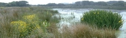
The project involved a walkover survey of the main watercourses of the River Lee catchment, Tralee, County Kerry to identify the locations where invasive floral species occurred. A pilot methodology for surveying invasive flora species of the catchment was designed and trialed. The data collected on the distribution and extent of invasive species was entered into a record database and mapped using GIS. This report presents the results of the 2011 survey. Recommendations are made in relation to management and control options for the invasive species recorded within the River Lee Catchment.
The primary objective of the County Kerry Invasive Species Survey 2011 project was to undertake a detailed survey of invasive flora species throughout the River Lee catchment, Tralee, county Kerry with the aim of identifying invasive species present and determining their distribution and extent throughout the catchment.
The survey focused on the following key species that are regarded as being problematic in Ireland O’ Flynn (2010):
Japanese Knotweed (Fallopia japonica)
Giant Knotweed (Fallopia sachalinensis)
Hybrid Knotweed (Fallopia japonica x sachalinensis)
Himalayan Knotweed (Polygonum polystachyum)
Himalayan Balsam (Impatiens glandulifera)
Giant Rhubarb (Gunnera tinctoria)
Rhododendron (Rhododendron ponticum)
Giant Hogweed (Heracleum mantegazzianum)
Fringed Water-lily (Nymphoides peltata)
Parrot's Feather (Myriophyllum aquaticum)
African Curly Waterweed (Lagarosiphon major)
Canadian Pondweed (Elodea canadensis)
Slender Pondweed (Elodea nutallii)
An extensive field survey was undertaken during July and August 2011. The main watercourses throughout the catchment were surveyed together with additional areas in the wider catchment.
During the field survey, a new record was documented each time an invasive species was encountered. Information relating to: habitats present, extent and abundance of the individual species, notes on human disturbance together with other site characteristics were recorded.
Following the field survey data for each individual encounter was entered into a record database and digitally mapped using GIS.
The final report ‘County Kerry Invasive Species Survey 2011 – Pilot Mapping Study of the River Lee Catchment, Tralee’ was prepared. The report summarises the results of the survey by providing:
• individual species reports which include distribution maps
• quantifies the extent of each species throughout the catchment
• elucidates on the possible source, habitat preferences, and methods of spreading of each individual species
The collation of information from the survey will form a helpful tool in future heritage conservation planning and eradication programmes in the county and assist in the development of sustainable planning programmes in county Kerry.
All data from the KISS 2011 project was submitted to the National Biodiversity Data Centre for inclusion within the National Species Invasive Database, National Parks and Wildlife Service, and to Inland Fisheries Ireland.
This project was funded by Kerry County Council and The Heritage Council.
For further information on the project please contact Cathy Fisher, Heritage Officer, Kerry County Council, Tralee.