Title
dfdfd
Site Navigation
[Skip]
Home
About Us
Company
Services
Baseline Ecological Surveys
Ecological Impact Assessment
Appropriate Assessment
Ecological Monitoring
Ecological Clerk of Works
Habitat Survey and Mapping
Aerial UAV Surveys
Flora Surveys
Bird Surveys
Fauna Surveys
Invasive Alien Species Surveys
Native Woodland Conservation Scheme
Projects
Ecological Impact Assessment
Appropriate Assessment
Ecological Monitoring
Ecological Clerk of Works
Industrial
Wind Energy
Solar Energy
Infrastructure
Quarries
Residential and Mixed Use
Wetland Surveys
Nature Conservation
News
Wetlands
Map of Irish Wetlands - Introduction
Contact Us
Links
Sitemap
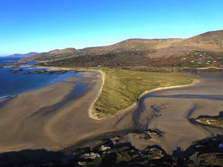
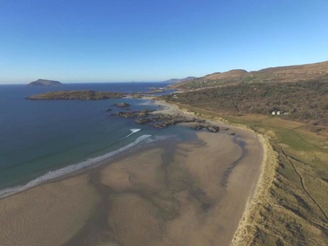
Aerial photographic survey undertaken by WSI of Derrynane, Kerry using drone
«
Discover Wetlands on World Wetlands Day 2017
News
Put your wetland photograph on the Map of Irish Wetlands
»
Tweet
1 Dec 2016 at 15:29
© Website design Peter Foss 2012
[Back To Top]